Friday, December 14, 2007

Quick Hitting Heavy Snows Paralyze Thursday Rush Hour

More Storminess On the Way This Weekend
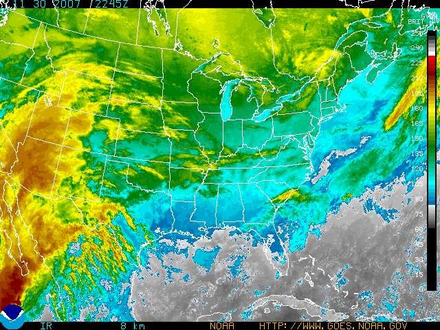
Downtown Boston traffic yesterday afternoon was much like it was in Lowell - gridlocked. Image courtesy WBZ 4

Snowfall totals were about 1-3 inches higher than I predicted Wednesday afternoon. Not too bad, considering most other predictions at the time called for 2"-4" in Lowell.....
Nothing like a little snow to get us in the holiday spirit!Image courtesy WBZ 4
Sunday's storm looks to be a coastal hugger - much like the December 1st storm that brought us about 4 " of snow, sleet, and freezing rain. The tracks will be extremely similar, cutting very close to Long Island and The Cape. This means we will likely change to a wintry mix of snow, sleet, and freezing rain for this storm, keeping accumulations down.

WINTER WALLOP WACKS MASSACHUSETTS!

Ahh, nothing like a little alliteration to start the blog off. Yesterday afternoon, conditions went from mostly cloudy and cold to heavy snow in about 1 hour. Snowfall rates of 1"-2" an hour were common across the Bay State for several hours yesterday, bringing hefty accumulations to much of Southern New England, and creating a traffic nightmare across the state.

The jackpot was in southern Massachusetts and east-central Connecticut, were many locations received right around a foot of dry, fluffy snow. A sleet mixture held down accumulations along the immediate south coast.

Lowell received right around 8 inches of the white stuff, making for one heck of a commute home yesterday afternoon. Downtown was a mess, and it took me 15 minutes just to get 1/4 mile from campus, thanks to some gridlocked stoplights. Intersections across the state were backed up for miles in some cases, with normally 15 minute commutes taking up to 5 HOURS in some cases! Highways were at a standstill, and plows were rather ineffective sitting in the traffic jams.

People have been criticizing statewide response to the storm, claiming that roads were inadequately treated, and that schools and businesses should have closed earlier. Many students were stuck on buses for hours yesterday trying to get home. Read up on it here: http://www.thebostonchannel.com/news/14852919/detail.html

My future advice - don't wait until the snow starts to head on out. By then, it's often too late......

That being said, we will be watching a potent, juicy storm heading up the Atlantic seaboard this weekend. It will tapping into some tropical moisture and will be winding up as it tracks north toward New England.

However, this system looks right now to be a coastal hugger, meaning warmer air aloft will likely work into the region. The bottom line - this storm probably won't be all snow. Instead, we will likely see snow to start, changing to a mess of heavy snow, sleet, freezing rain, and possibly rain.

The impending Nor'Easter looks to take a very similar path to the 12.1.07 storm, which skirted just south of Massachusetts and the Cape - although this storm will be stronger when it passes us by. My best guess now is a good 3"-6" of snow in Lowell before things change over to an icy mess. As always, this storm is still a ways away, and details will be in much better focus as we get closer to the event. With these borderline situations with regards to precipitation type, a slight shift in storm track can make a huge difference in snowfall totals. Basically, things could change. I recommend that you continue to monitor the situation. If the storm decides to take a more easterly track, we will remain socked in with colder air for a longer period of the storm. This will increase our chances of heavy accumulations. Further to our north, Ski Country stands to get a a slug of a foot or more of snow. Stay tuned for updates.

And now here's your forecast:

Today: Mostly cloudy and milder. High near 38.

Tonight: Decreasing cloudiness. Temperatures drop to near 15 by early morning.

Saturday: Clear to start, clouds thicken up later in the day. Light snow showers possible by afternoon. Colder, with highs near 25.

Saturday Night: Cloudy with light snow likely late. Low 20.

Sunday: A mess! Snow, sleet, freezing rain, and rain. Precipitation could be heavy at times, especially the first part of the day. High 35. Winds becoming gusty from the east at up to 35 mph.

Extended outlook

Monday: Sunny and cold. High 28.

Tuesday: Continued sunny and cold. Highs in the upper 20s.

For WUML Lowell 91.5 FM this is WUML weather director and UMass Lowell student meteorologist John Webster. Have a great weekend everyone!

Thursday, December 13, 2007

SNOWSTORM!

Currently in Lowell and surrounding area's, we are under a haze of snow. Evening classes were cancelled tonight on campus, and for good reason. I left at around 2:50 and it took around 2 hours to get home - Normally this is a 45min-1hour drive! As you can all probably see from your windows, we have had a LOT of snow fall since the first few snowflakes began falling. Roadways were a mess earlier today, and seem to still be a mess now. There is a heavy snow warning out for our area currently as well.


Traffic Report (from SmartTravler.Com) for the Boston Area:

I-495 North (Mass Pike/I-90 to Rte. 3)
Traffic is extremely heavy and slow, severe delays.

I-495 North (Rte. 3 to I-93)
Traffic is extremely heavy and slow, severe delays.

I-495 North (I-93 to I-95)
Traffic is extremely heavy and slow, severe delays.

I-495 South (I-95 to I-93)
Traffic is extremely heavy and slow, severe delays.

I-495 South (I-93 to Rte. 3)
Traffic is extremely heavy and slow, severe delays.

I-495 South (Rte. 3 to Mass Pike/I-90)
Traffic is extremely heavy and slow, severe delays.

Everone be careful!
Onto the forecast:
Tonight: SNOW! Should be clearing up as the night wears on. Low of 20 degrees.
Friday: Reading day for UML students! Mostly sunny, a nice change from Thursdays snow, and should give everyone plenty of time to shovel. High 35.
Friday Night: Clear, cold. Low 13.
Saturday: Chance of snow at night (late, past midnight), and cloudy all day. High 25.
Sunday: Sleet/Freezing rain possible during the day, and snow possibly at night. High 27.
Have a good weekend everyone, good luck on finals!

Wednesday, December 12, 2007

2 Potentially Major Winter Storms May Impact Southern New England

Possible Quick-Hitting but Heavy Event Thursday Afternoon

All Eyes Tracking Nor'Easter for Sunday


Click here to go directly to today's forecast!


Possible snow totals through tomorrow night for a short-duration but possibly heavy snow event. Click to enlarge.

WINTER STORM WATCH IN EFFECT FOR MASSACHUSETTS NORTH OF THE MASS PIKE

HEAVY SNOW WARNING IN EFFECT FOR SOUTHERN MASSACHUSETTS SOUTH OF THE MASS PIKE


1 day left of the semester, and I still have a homework set and an exam, both tomorrow. This isn't counting the projects and finals I have starting next week. Throw into the mix two possible big winter storms, and things sure are busy around here!

Although I should currently be finishing up my advanced dynamics homework (gotta love homework due on the last day) I felt compelled to throw in a blog entry, being that we have some important weather possibly on the horizon.

Storm 1 happens tomorrow from ~2pm and ending ~9 pm. This storm is actually rather weak, and a fast mover. However, local dynamics with the system favor a quick burst of moderate to heavy snow over the region. In fact, models have been trending to steadily increase precipitation amounts here. That being said, yesterday at this time most of the computer models gave us NO SNOW for tomorrow. Today they are churning out close to a foot for parts of southern Massachusetts. Quite the little 24 hour turnaround there.

Will they flip-flop again, like Mitt Romney on a hot day? We will know much better by tomorrow morning. However, one of the computer models has been rather steady in predicting this heavy slug of snow, and other models have been trending toward it. My current thinking is that the above snowfall map will verify.

Check out the maps below to see what some of the models are churning out for precipitation. It will be cold here for the event, so keep in mind that the water to snowfall ratio for us tomorrow will be about 1:15, meaning that .5 inches of liquid equivalent would equal about 7-8 inches of snow......

Computer model graphic showing liquid water possible from tomorrow's storm.
A 3 hour precipitation total, using high resolution computer model. If this pans out tomorrow afternoon, southern Massachusetts could see snowfall rates of 1-3 inches an HOUR!

After a break Friday and Saturday, all attention will shift to a possible major coastal storm which looks to form near the Carolinas on Saturday and move up the coast towards New England. The potential exists for a significant amount of snow from this event. Where it stays all snow, we could see over a foot. Gusty NE winds and beach erosion are possible as well.

However, this event is still days away, and computer models have been known to change their minds pretty late in the game. They have been rather consistent with this storm though, with minor differences in storm track. Earlier model runs in the week showed a MUCH stronger storm (we're talking possible blizzard conditions) but they have been steadily trending towards a weaker scenario. The storm still looks to be potent though.

Check out my nifty home-made graphic below to get a sense of the main players for Sunday's storm.


A track closer to the coast would mean a snow to mix to possibly rain scenario for Lowell. If the storm stays further out to sea, we would remain all snow. In addition, there is ample moisture in the tropics, partially thanks to dissipating sub-tropical storm Olga. If the storm is able to tap into that moisture sooner than currently predicted, we could be in for a wild Sunday!


The above is a map of available moisture at lower-mid levels of the atmosphere as of Saturday afternoon. Note the plume of warm, moist tropical air extending from the Gulf of Mexico to the Atlantic.


Current precipitation output for the Sunday storm. Liquid equivalent amounts are in excess of 1" for our area, meaning that the potential exists for some heavy snows. Again, note the plume of heavy moisture off the coast which remains separate from the main storm system. If they join forces, look out!


So in a nutshell, quick 6 hour or so burst of moderate to heavy snows tomorrow afternoon, with the highest amounts south of the Mass Pike. The snow could come down heavily, so you may want to plan your commute accordingly. If this pans out, tomorrow's commute will be a mess.


We will have future updates on tomorrow's storm and the possible weekend Nor'Easter as we draw closer to the events. Make sure to check back for updates! And now for the forecast.....

Lowell Regional Forecast

Tonight: Clear and cold. Low 20.


Thursday: WINTER STORM WATCH. Clear to start, with rapidly increasing clouds. Snow, possibly heavy, likely after 3 pm. High near 27.


Thursday Night: Snow winds down around 9-10pm. Total storm accumulation of 4"-8". Low 20.


Friday: Clearing and warmer. High near 38.


Saturday: Becoming cloudy. Light snow possible by afternoon. High 32.

Extended Outlook


Sunday: Cloudy with snow, possibly changing to a wintry mix. The snow could be heavy at times. High 33.


Monday: Mostly sunny. Highs in the upper 20s.


For WUML 91.5 FM this is WUML weather director and UMass Lowell student meteorologist John Webster.

Monday, December 10, 2007

Winter Storm hits Mid West Pretty Hard but leaves us with less than expected total accumulations.

Many forecasters were predicting around 1-3 inches of snow and sleet accumulations for the Lowell area Sunday night into today; but in the end we received mostly small traces of freezing rain and ice throughout the area. Many New Englanders were busy scraping the ice off of their cars this morning; but luckily ice accumulations were less than colossal.

In contrast the state of Oklahoma has declared a state of emergency. Many areas in the mid western United States, Oklahoma included, are left without power due to an inch of ice which has coated power lines across the highly affected area. The storm is also to blame for 13 deaths in the mid west- mostly due to interstate collisions c
aused by the thick layer of ice covering roads. The storm took the life of a homeless person in Oklahoma City... the cause of death was hypothermia- medical officials evaluated. Some schools remained closed for the day; and many others had morning delays.

Looking ahead into our week... we could be seeing some more freezing rain late Tuesday or Tuesday night. We've also got our eye on another winter storm system that could approach us by Wednesday night lasting into Thursday night. This storm, as of now, looks as though it will mostly consist of rain on Wednesday looking at the image above- perhaps a significant amount, but we will keep you posted on how things change. A large amount of snow is also expected for Thursday.

THE FORECAST!

Tonight's forecast: we'll see a low around 18 degrees tonight under mostly cloudy skies becoming partly cloudy around midnight.

Tuesday: High around 37; partly sunny then becoming cloudy with a chance of freezing rain/ light rain. Low around 20

Wednesday: Mostly cloudy with a chance of rain shower in the morning. High of 41. Becoming sunny in the afternoon with winds between 10-20 mph with 30 mph gusts. Mostly clear Wednesday night with a low of 33. It is uncertain whether the bulk of the winter storm will start Wednesday night equaling more freezing rain/rain accumulations than snow or Thursday which could bring us more snow.

Thursday: Partly sunny. Chance for snow is expected. Much colder with a high around 29. Snow continuing through the night... low around 16.

Friday: High around 37 under mostly cloudy skies. another chance for snow showers. Low around 26.

Saturday: High of 27. Partly sunny becoming mostly cloudy Saturday night. We could see some more light snow. Low around 20.


For WUML this is UMASS Lowell student meteorologist Lucie Rawlins

Sunday, December 09, 2007

Wintry Week Ahead for Lowell


Two years ago on December 9th, we had a surprise snowstorm that dropped more than 1 foot of snow in about 4 hours, making the Friday afternoon commute a messy one. Snowfall totals from the storm above - click to enlarge.

Current satellite imagery showing a small storm system advancing east towards New England, which will give us a mixed bag of precipitation through tomorrow.

A series of small storms will be impacting our area through the upcoming week. Although none of the storms look to be very strong, they will make driving a headache for some of us, with three seperate wintry events possible during the workweek. Tonight's storm looks to leave us with 1-3 inches of snow and sleet, with some icing on top (no, not the cake icing!) Our below average temperatures will continue as December has proved to be rather wintry so far.


Apologies for the infrequent postings, however, a heavy course schedule coupled with impending finals, projects, and a flurry of last minute exams thrown at me by professors has left me with very little available time to devote to the blog. Unfortunately, this trend will continue until the end of the semester. However, if there are any major weather events on the horizon, I will make sure to stop by to let you know.


And now for the detailed forecast:


Tonight: Snow mixing with sleet at times. Changing to a mix of snow, sleet, freezing rain, and possibly rain towards dawn. Low near 26. 1-3 inches of accumulation possible.


Monday: Cloudy with light freezing rain possible early. Remaining cloudy with leftover patchy drizzle for the afternoon, with a scattered snow shower possible. High 34.


Monday night: Partly cloudy. Low 22.


Tuesday: Becoming mostly cloudy, with light rain or snow possible by afternoon. Mixed bag of precipitation possible during the overnight. High 35.


Wednesday: Mostly sunny. High near 38.


Thursday: Cloudy, with another bout of snow and sleet possible. High 33.


Friday: More clouds than sun. High 37.

For WUML 91.5 FM this is WUML weather director and UMass Lowell student meteorologist John Webster. Have a great week!

Thursday, December 06, 2007

Look at how nice and clear it is right over Mass today! Today was very clear, however incredibly cold, but tomorrow looks like there will be a chance of snow. The temperatures in Lowell this week are actually below average, normally this time of year temperatures would be in the low 40's, however we've seen highs this week that are only reaching into the 30's. Saturday will certainly be your pick of the week, with the day being clear, and temperatures actually moving into the 40's.
For those of you who love the snow and the cold, friday may bring in some snow showers, and we might see some sleet/snow on Sunday.

And onto the forecast!
Today: Clear skies all morning and afternoon. Highs today were in the mid 30's. Tonight will still be clear and cool, with temperatures moving into the high teens.

Friday: The morning brings partly cloudy skies, and we may see some afternoon snow showers. The high will be around 35 degrees.
Friday night has a continuation of the snow showers, and a low of 25.

Saturday: Clear all day, and warming up a bit to a high of 44.

Sunday: Snow and sleet, with a high of 37 degrees.

Hope everyone enjoys their weekend!
This is student meteorologist Johnna Infanti, for WUML 91.5 FM.

Monday, December 03, 2007

For Much of New England... School's out!

SNOW DAY!!!!


Many schools across New England are closed due to the winter weather. Many parts of Massachusetts received around 2-4 inches on average where parts of New Hampshire received an average of 3-6 inches. Though the amount of snow is nowhere near colossal; the freezing rain and sleet that accompanied it was enough to close some schools and businesses for the rest of the day. You know what that means parents with small children...?

Hehe...

But the good news is that the snow is wet and sticky.. which makes for ideal sledding, snowman, and winter activity conditions.


Statement as of 11:25 am EST on December 3, 2007


The following are unofficial observations taken during the past 10 hours
for t
he storm that has been affecting our region. Appreciation is extended to Highway departments... cooperative observers... Skywarn spotters and media for these reports. This summary is also available on our home Page at weather.Gov/Boston
********************storm total snowfall********************

Location storm total time/date comments snowfall of (inches) measurement
Massachusetts
...
Essex County...

Lawrence 4.0 651 am 12/3 spotter
Methuen 4.0 820 am 12/3 spotter

Lawrence 3.9 720 am 12/3 spotter NWS coop
Salisbury 3.5 608 am 12/3 spotter

Topsfield 3.3 645 am 12/3 spotter spotter

West Peabody 2.8 732 am 12/3 spotter spotter

Ipswich 2.6 541 am 12/3 spotter ...

Franklin County...

East Charlemont 3.5 1020 am 12/3 spotter
Greenfield 2.8 711 am 12/3 spotter NWS coo
p
Sunderland 2.3 1025 am 12/3 spotter ...

Middlesex County...
Tyngsborough 4.8 806 am 12/3 spotter spotter
Winchester 3.8 1003 am 12/3 spotter

Lowell 3.6 720 am 12/3 spotter NWS coop

North Wilmington 3.3 415 am 12/3 spotter

East Pepperell 3.1 627 am 12/3 spotter

Pepperell 3.1 627 am 12/3 spotter spotter reading 3.0 904 am 12/3 spotter ham radio
Townsend 3.0 604 am 12/3 spotter
Ayer 2.5 6
53 am 12/3 spotter spotter
Waltham 2.5 725 am 12/3 spotter spotter
...

Suffolk County...

East Boston 1.3 1100 am 12/3 spotter Logan Airport ...

Worcester County...


Ashburnham 2.5 355 am 12/3 spotter


New Hampshire
...

Cheshire County...
Walpole 6.0 700 am 12/3 spotter NWS coop

East Alstead 4.0 700 am 12/3 spotter

Keene 3.0 559 am 12/3 spotter
Marlow 3.0 721 am 12/3 spotter NWS coop
...

Hillsborough County...
Francestown 5.0 749 am 12/3 spotter NWS coop
Brookline 4.0 947 am 12/3 spotter

Peterborough 4.0 728 am 12/3 spotter spotter

South Weare 4.0 830 am 12/3 spotter

Wilton 3.3 820 am 12/3 spotter

Nashua 2.8 554 am 12/3 spotter

We should be expecting a COMPLEX STORM SYSTEM coming from the great lakes.
This storm will intesify bringing us some rain, sleet, and more snow by the afternoon  and into Tuesday morning as it redevelops in the area.
Those accumulations are not expected to exceed an inch. But as the storm pushes more towards the Northeast

It is expected to strengthen.


Later on this week we should see a week low
Pressure system Wednesday night followed by
high pressure Thursday.

And your forecast for the rest of the week...

Monday:
High of 34
Low: 23
Rain, sleet, snow and rain... total accumulation equaling around an inch. NE wind at 10 to 15 mph Becoming mostly cloudy tonight. Chance of more snow.


Tuesday:
High 32
low 26
Mostly cloudy and bluster. Chance of snow early in the morning. Around a quarter inch. Windy with 20-25 mph winds from the W and gusts up to 40 mph


Wedesday:
High 34
Low 22
Mostly sunny in the am. Then becoming mostly cloudy. W winds 5-10 mph


Thursday:
High 31
low 18
Sunny! then mostly clear at night

Friday:
High 37
Low 19
cloudy with a chance of snow. Then becoming cloudy Friday night with another possibility for more snow.

For WUML this is UMASS Lowell student meteorologist Lucie Rawlins.

First Major Winter Storm of the Season Hits All But Extreme Southern New England


Wind Advisory In Effect from 4 PM - 7 PM for Most of Massachusetts


Winter Storm Warning Remains in Effect for Much of NH and Maine.

Snowfall predictions as of Saturday afternoon superimposed with storm totals as of this morning. Click to enlarge.


Regional map of storm totals. It's not all done quite yet.


Surface wind field off the Massachusetts coast. The storm is currently gaining strength to the east of Cape Cod - where the winds are lighter (light blue). If you look closely, you can see the counterclockwise rotation around the currently elongated low.
Wind field over New York and Pennsylvania. I put this in because the winds here are from the WEST over northern New York state, while they are from the North over much of Southern New England. Where these wind fields converge, we could see some enhanced snowfall this afternoon.


Current visible satellite. The black dot to the east of the Cape is the center of the surface low. Not exactly an "eye", but worth noting.

Current local radar shows precipitation blossoming on the backside of the storm.
Earlier regional radar. The echoes have filled in the last couple hours as the storm deeepens off the coast. Because of the low-level convergence over our area, we could see a decent band of snow this afternoon with an additional 1-3" on snow-covered surfaces.
Enhanced infared imagery showing the center of the storm (the light blue circular area) located to the east of Cape Cod.


Well, our winter is off to a fun start! Dec. 1st marks the first day of meteorological winter, and we aren't that far off the mark with our first snowstorm! Last night, precipitation in Massachusetts ran the gamet from snow to sleet to freezing rain. Lowell was JUST on the northern fringe of the snow line for much of the event, giving us accumulations right around the 4" mark as of this morning.


As the storm intensifies off Cape Cod this afternoon and heads into the Gulf of Maine, we will see additional accumulating snows on the backside of the storm, on the order of 1-3 inches. We normally don't see much snow on the "backlash" of the storm, however, the parent storm currently located over the Great Lakes is still relatively strong, and low level winds are from the west over upper New York State. As this air flow collides with the northerly winds from the developing storm off the coast, we will likely see a decent band of moderate snows this afternoon in Essex and Middlesex counties, which will likely add another 1-3" to our current storm totals.


Winds will start to crank this afternoon as the low strengthens, and we could see gusts up to 40 mph. So hang on to your hats!


The storm is expected to move SLOWLY through the Gulf of Maine through tomorrow, keeping clouds and windy conditions through the area, although the accumulating snows should be over by this evening.


The rest of the week looks to remain on the wintry side, with colder than normal temperatures, mostly cloudy conditions, and a slight chance for snow Wednesday and Friday.


And now on to the forecast.


Rest of today: Wind advisory in effct this afternoon. Cloudy with snow accumulating an addition 1-3". Becoming windy. Temperatures slowly falling through the upper 20s. NW winds 10-20 mph, with gusts up to 40 mph possible this evening.


Tonight: Cloudy and windy early, with a chance of light snow showers. Little additional accumulation. Lows near 24.


Tuesday: Mostly cloudy and continued cold. Chance of a morning flurry. High 34.


Tuesday night: Mostly cloudy. Low 20.


Wednesday: Mostly cloudy with the chance of a snow shower. High near 33.


Extended Outlook


Thursday: Here comes the sun! Mostly sunny, high 34.


Friday: Mostly cloudy. Slight chance of light snow. High near 36.


For WUML 91.5 Fm this is WUML weather director and UMass Lowell student meteorologist John Webster.

Saturday, December 01, 2007

Dust Off Your Snow Shovels !


Wintry Mess Monday Morning to be Bookended by Periods of Accumulating Snow


Current thinking of total snow and ice accumulations by Monday NIGHT.


Satellite view of the storm, currently located over the upper Midwest.


Computer model projection for 7 am Monday, showing the secondary storm just starting to form near Cape Cod. Note the dashed red line, showing warmer air at mid-levels spreading into southern Massachusetts. This warmer mid-level air should change the snow over to a mix of snow and sleet early Monday, cutting down on potential accumulations.
As the storm deepens and pulls away Monday, cold air will rush back into Massachusetts, and any mixed precipitation will change back over to snow. We could see 1-3 inches from this backlash, making Lowell totals in the 4-7 inch range.
Weather map for Monday morning.
This storm will have a decent amount of moisture to work with. Liquid precipitation totals are pictured above. If this storm were all snow, we could be looking at 10-15 inches.....but that is highly unlikely.


Ahh, the exciting Saturday nights of a meteorolgy senior... no, I'm not meeting up with friends at the local bar for a good time - I'm at home, making a REALLY strong cup(s) of coffee, and settling in for a night of homework and studying after working from 9am-4pm. Since we have an important storm coming up, I figured I might as well throw my two cents in with an important update!


Computer models haven't changed all that much from yesterday... they did a little colder-warmer-colder see-saw, of which I didn't feel like jumping on the bandwagon, despite some of the larger media outlets doing so. That being said, I am raising total expected storm accumulations by a smidge - right now it looks like the Lowell area will see 4-7 " by the time all is said and done.


I do want to point out that the total accumulations above are as of Monday night. We will have 2 bursts of accumulating snows - 1 Sunday night to start the storm, after which it will likely change to a mix of snow, sleet, and possibly rain by early Monday morning, after which it will change back to snow as the storm pulls away.


We could see 2-4" of accumulation for the first part of the storm, and another 1-3 in the storm's backlash Monday afternoon. Needless to say, Monday looks pretty messy for these parts.


By Monday night, we are left with lingering clouds and possibly some light snow/flurries, but the heavy stuff will be long gone. However, winds will start to crank Monday afternoon, and that will last through much of Monday night.


If you check out the snowfall graphic at the top, there is a rather tight gradient between 2-4" and 6-12". If you shift everything 50 miles north or south, that will lead to some pretty different snowfall tallies. Being that it is Saturday night, and the storm isn't forecast to wind down until Monday night, these amounts will likely need to be tweaked as we get closer to the start of the storm. Barring no surprises though, I think the above is a pretty good estimate given the current data.


For whatever reason, the National Weather Service has chosen NOT to issue a winter storm watch for our area - most likely because storm totals over 6" are not a guarantee for Lowell (6" or more being the threshold for a winter storm warning). However, as new model data comes in, that could change. If I were in charge, I would have issued a watch for our area. But I'm not. In any event, we'll keep you posted.


In the meantime, arctic air will make for a frigid night tonight. Temperatures fell through the 20s for most of the day today, and coupled with the wind-chill, it felt like it was in the single digits and teens out there. Tonight will be no exception.


Tonight: Bitterly cold! Increasing high cloudiness. Low 7. Wind chills near zero!


Sunday: Clouds lowering and thickening throughout the day. Furries possible late afternoon. steady light snow breaks out between 8 pm and midnight. High 31.

Sunday Night: Light snow becoming steadier and heavier. Snow will likely mix with sleet and possibly freezing rain after 3 AM. Low 32.


Monday: AM Mess! Snow/sleet/rain mix early, changing back to all snow by mid-morning or early afternoon. Additional light accumulations possible. High 36. East winds becoming North at 10-15 mph, with gusts up to 35 mph possible late.


Monday Night: Cloudy, with light snow or flurries possibly early. Little if any additional accumulation expected. Cold and windy, with lows near 22.


Tuesday: Mostly cloudy. Chance of a flurry. High 33.


Wednesday : Partly cloudy. Highs in the lower 30s.


Thursday: Mostly cloudy with a chance of snow showers. Highs in the lower 30s.


For WUML Lowell 91.5 FM this is WUML weather director and UMass Lowell student meteorologist John Webster. Make sure to check back tomorrow for an important update!


Friday, November 30, 2007

Wintry Mess Likely for Sunday Night and Monday

Exact Storm Track to Determine Precipitation Type
Current enhanced infared satellite view. The storm which will begin to affect us Sunday night is currently taking shape out west, as evidenced by the higher cloud tops in yellow and orange. Click to enlarge.

Before the storm pays us a visit, it will be impacting much of the country. This is the season's first major winter storm event for the United States. Detailed model analysis, showing various computer model projections for the path and location of Monday's storm. The different colors represent different forecast times, and the many symbols indicate where different computer models put the center of the low pressure system for each timeframe. Click to enlarge.
If the last graphic was confusing, this one should be better. Simplified projection on the location and path of the storm system traversing the country which will affect us Sunday night and Monday. Note the dot to the southeast of Long Island, indicating where the secondary coastal low is now forecast to develop. Click to enlarge.
Total precipitation for the upcoming storm could exceed 1.25 "of liquid water equivalent.... If it were ALL snow, that would be about a foot!


Temperatures will take the plunge the next couple days, as arctic air begins to move south out of Canada. A cold front passing the region this evening will make sure of that.


Although the weather Saturday will be quiet - the proverbial "calm before the storm," it will get downright FRIGID tomorrow night. Overnight lows will be just above 10 degrees, so make sure to bundle up if you plan on hitting the town tomorrow night.


All this cold air sets the stage for Sunday and Monday. A low pressure system will approach us from the west on Sunday, and will be located over the Great Lakes by Sunday evening. Snow will likely begin to overspread the area in advance of the approaching system sometime early Sunday night.


By early Monday morning, a secondary coastal storm will begin to spin up in the Atlantic. Yesterday, model consensus was that this storm would form near Cape Cod, and track northeastward into the Gulf of Maine, intensifying as it moved away. Today, computer models have begun to shift the low pressure formation further south and west, just off the coast of Long Island. Refer to the graphics above for a good indication of where the storm looks to get going.


What does this mean for us? It could indicate that the colder air may be tougher to scour out than originally thought, and it could provide us with more moisture as the storm's dry slot will not form over the region.


However, east winds off the warmer waters of the Atlantic will be a big player in this system. Right now, it does appear that warmer air will work into the middle layers of the atmosphere for a decent portion of the storm, which would mean we would see a mixed bag of snow, sleet, freezing rain, and rain - especially late Sunday night and early Monday.


By Monday afternoon, the precipitation could change to all snow as colder air wraps into the system from the north. However, the precipitation will be starting to wind down at this point, so I expect light accumulations from the backlash.


The big question everyone wants to know is HOW MUCH WILL WE GET?
Keep in mind that this event won't be over until Monday night, and its only Friday, so we are still a ways out. My best guess at this point would be 2-4 inches of heavy, sloppy, wet snow/sleet accumulating through Monday night. You know, the cement-like stuff that's oh-so-fun to shovel....


However, one of the computer models has been keeping the system further south, and our area colder for the storm. If this scenario verifies, our totals could be more in the 4-8" range. I think it's too early to make that prediction just now, but if the models start to converge on a colder solution tomorrow, accumulations may need to be increased for the Lowell area.


Make sure to check back tomorrow for an all important update. And now here's the forecast......

Lowell Regional Forecast

Tonight: Mostly clear and cold. Low 24.


Saturday: Mostly sunny and cold. High near 31. Gusty NW winds at 10-20 mph will make it feel like it's upper teens to low 20's.


Saturday Night: Clear and Frigid. Lows near 12.


Sunday: Clear to start, becoming mostly cloudy by afternoon. High 33.


Sunday Night: Cloudy, with light snow possible by evening. Precipitation will become steadier and heavier during the overnight. Snow may mix with and change to sleet and rain, especially towards morning. Low 26.


Monday: Morning communte could be a mess. Mixed bag of wet snow, sleet, and rain during the morning, ending as a period of light snow during the afternoon. High 35.


Tuesday: Partly cloudy. High 34.


For WUML Lowell 91.5 Fm, this is WUML weather director and student meteorologist John Webster urging you to check back for an important update tomorrow.


Have a great weekend everyone!

Thursday, November 29, 2007

VERY TRICKY FORECAST FOR POTENTIAL WEEKEND STORM


Click here to go directly to today's forecast!


Living in New England is one of the most challenging, and interesting, places to live if you are in the business of forecasting the weather. Let's face it - we have it all.....springtime rains/floods, summer heat waves and thunderstorms, an occasional tropical system, and finally winter storms.

Winter storms are one of the most difficult weather features to forecast. Not only do we need to worry about storm intensity, but we obsess over the potential track of the storm. Why all this scrutiny? It all boils down to precipitation type - a shift in the storm track of 50 miles can make the difference between a rainstorm and a whopper of a snowstorm. To complicate matters, a storm track shift of 50 miles is a drop in the bucket when attempting to forecast from several days in advance.

Well, now that we have THAT out of the way, let's talk about how things look to play out at this stage in the game. We saw a cold front move through New England today accompanied by some scattered showers. Temperatures will be cooler by tomorrow, and downright cold by Saturday as arctic air begins to spill south out of Canada. In the meantime, a storm will start to organize out west over the 4-corners region by tomorrow night, and start heading into the Plains. Keep in mind, this system hasn't even formed yet.

As the storm moves northeast, it will be located over the eastern Great Lakes by late Sunday. Now comes the tricky part.

Computer models have been flopping like presidential candidates in the hot seat the last couple days... the main questions being if a secondary storm will develop over the Atlantic, where does it develop, and how intense does it get? I can say with confidence that we will see a secondary storm develop, however the details of exactly where and how quickly it intensifies are still up in the air.Check out one of the models below to see the latest thinking on where the secondary storm will start to spin up.

Computer model prediction for 7 AM Monday morning, with a secondary storm beginning to form very close to Cape Cod. Click to enlarge.
Computer model prediction for 1 PM Monday, showing most of the precipitation to our north by this time. Click to enlarge.

Ahead of the main low pressure over the Great Lakes, moisture will spread east in advance of the system, and we will likely see light snow overspread the area by late Sunday afternoon or evening.

As the secondary coastal low starts to form Sunday night, the energy from the primary storm will transfer to the coast. The new low pressure system will begin to intensify rapidly as it moves north.

However, current thinking is that the secondary low will form very near Cape Cod, and not get stronger until it is north of us in the Gulf of Maine. What does this mean for us? Right now, it looks like the heavy snows will fall in northern New England, and not in our neck of the woods. Warmer air will likely infiltrate the region from the Atlantic with winds being due east with the storm position near Cape Cod.

So, to sum it up, we probably start as light snow Sunday evening, mix with sleet and rain late Sunday night/early Monday, and then switch over to just plain old rain during the day on Monday. We could see the precipitation end as some light snow or flurries as the storm blows up east of Maine, and drags down colder air via strong northerly winds.

Below is a graphic based on the latest computer models depicting the most likely result of the Sunday/Monday event.


Tentative prediction for track of the upcoming storm, with a weak Low forming near Cape Cod and intensifying in the Gulf of Maine. To the north of the white line, all snow is likely from the event, with heavy amounts possible in ski country and Down east Maine. Between the green and white line, mixing appears likely with light snow accumulations possible. To the south, a quick period of snow to start followed by mostly rain is the best guess at this time.

Pretty far in advance, but this could be your wakin'-up-weather for next Monday. Again, conditions could be very different at that time depending on the actual track of the storm.


Now, I must issue this caveat - this storm is still over 3 days away, and much can change during that time-frame. As of now, it looks like Lowell may get a slushy 1-3 inches of snow before the change over to rain late Sunday night/early Monday. HOWEVER - if the storm forms further southeast and intensifies more rapidly, we could be looking at a colder, snowier scenario. If it is weaker and further north, we would be looking at more of a rain event.

Check back for important updates. The WUML weather team will be tracking the progress of the system closely. Details will become clearer as we draw closer to Sunday.

And now for the forecast......


Lowell Regional Forecast

Tonight: Partly cloudy and brisk. Low 26. West winds 10-15 mph, with gusts up to 25 mph.

Friday: Mostly sunny and breezy. Cooler, with highs near 42. NW winds 10-15 mph, with gusts up to 25 mph possible through early afternoon.

Friday Night: Partly cloudy. Low 23.

Saturday: Bundle up! Mostly sunny, windy, and seasonably cold. High 33. NW winds around 15 mph, with gusts up to 30 mph possible.

Sunday: Increasing cloudiness, with light snow possible after dark. High 33.

Sunday Night: Light snow mixing with sleet and rain, changing to all rain by early morning. Low near 29.

Monday: Morning rain tapering off by mid-afternoon. The precipitation could end as light snow or flurries. High 40.

Tuesday: Partly cloudy. Highs in the upper 30s.

For WUML Lowell 91.5 FM this is WUML weather director and UMass Lowell student meteorologist John Webster. Make sure to check back tomorrow for an important update!